A Road Through the Wilderness: Shenandoah National Park

By Amy Beth Wright
Shenandoah National Park came of age in the same era as the automobile. In the museum at the Harry F. Byrd Visitors Center, at milepost 51 of Shenandoah’s 105 mile Skyline Drive, a preserved “See the USA in a Chevrolet!” advertisement reminds visitors that the park was designed to comfortably bridge the gap between the wilderness and the suburbs.
Established in 1935, Shenandoah was conceived as an east coast counterpart to thriving western national parks like Zion, Yellowstone, Glacier, and Yosemite. Skyline Drive overlooks the Shenandoah Valley and the Blue Ridge Mountains, some of the oldest on the planet, and worn down by hundreds of millions of years of erosion. The park is atypical in that it is, in large measure, a constructed wilderness. Creating Shenandoah involved relocating 1,000 families, in some instances prompting years of litigation before settlement. The Civilian Conservation Corps built 75 overlooks of the Shenandoah Valley, manufactured gapes from Skyline Drive that render visitors speechless, awed, contemplative, reflective, and renewed. The CCC also deepened the presence of already thriving flora like oaks, beech, maples, hemlocks, and further re-introduced wildlife like deer, trout, black bears, and turkey.
The park, which spans the length of Skyline Drive, is broken up into north, central and south sections. The north end is 75 miles south of Washington, D.C., and day-hikers and casual leaf-peepers populate the overlooks. Further south, expect to see more Appalachian Trail through-hikers and distance cyclists; given the intermittent tourist traffic, the scenic overlooks in the south have a more isolate quality.

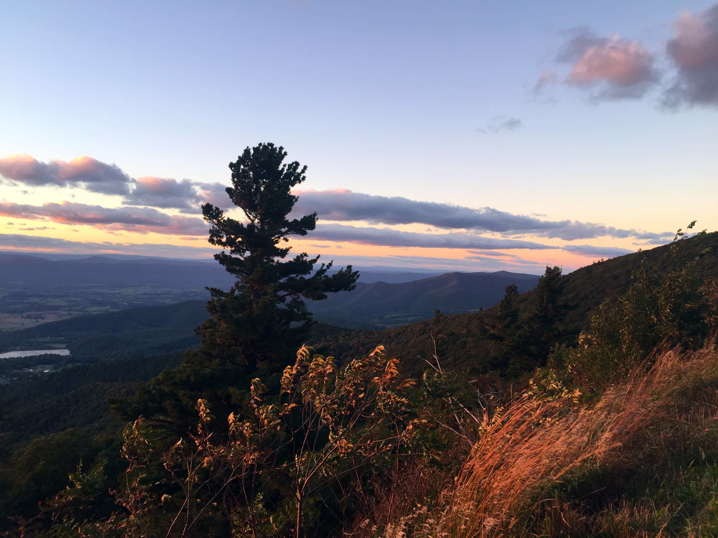
From Jones Run Trail.
We flew into Charlottesville, Virginia, and lodged at a Holiday Inn Express in Ruckersville, about 25 minutes from the park’s Swift Run Gap entrance at milepost 65.7. On our first day, we continued south to the end of the drive. As the park was shrouded in cottony white fog, and yet is defined by its abundance of scenic overlooks, it was an odd start; we stopped at Bacon Hollow and Eaton Hollow overlooks, but as the landscape was obscured, we determined to hike some of the interior, warming up with the short and steep Frazier Discovery Trail on Loft Mountain. This is across the drive from the Loft Mountain wayside at milepost 80, where there is a souvenir shop (typical of the three others in the park), and cafeteria with sandwiches, soft pretzels, ice cream, and soft drinks; this was our first indication that the original concept of the park as a destination for motorists, as opposed to those in deep retreat into the wilderness, was well intact. Look for the Mobile Visitors Center in the parking lot at Loft Mountain, or at the other southern stops, a cool van outfitted with the NPS logo on the side. Two kind park rangers were on hand to answer questions, and, as any other, this visitors center offers trail and park maps and a Passport stamping station. We had a magical experience hiking in the fog. From the crest of the Frazier trail, the landscape appeared in fleeting glimpses through the drifting cloudscape. Another great hike on this end is between mileposts 84 and 85, via the Jones Run parking lot and near the Dundo campgrounds. We hiked 1,100 feet down to the valley floor to Jones Run Falls, a 42-foot drop against black granite; at the end of the hike, you will see many amazing rock features and an open view up to the top of the ridge from where you descended. Again, our hike had a mystical quality, like walking through a medieval fairy tale forest, and the sense that we could happen upon a royal, a wizard, an elf, a bag of stars, or a keyhole entry into a tree.
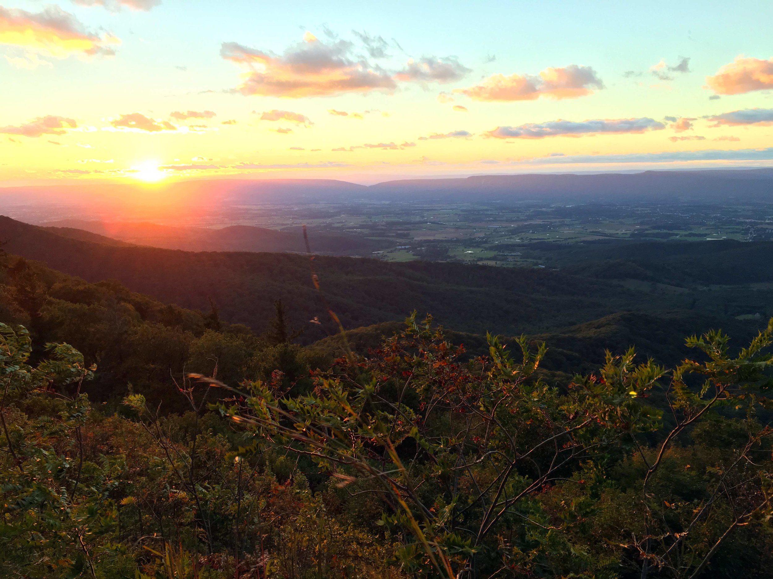
In the days that followed, the fog dissipated and the views were stunning; from a distance, the closely planted treetops create a soft, carpet-like texture, and underneath the mountains flow, rise, and recede back into the valley. In the distance, the Blue Ridge mountains are like set pieces rolled in from the wings, two dimensional tiered panels with tiers and slopes of blue and grey light; at sunset, it is periwinkle, and rimmed with orange. Massive Frasier fir trees, descendants of ice age survivors, are in sparse groupings along the trails; when the air was much colder, conifers blanketed the hills in greater abundance here. We again entered the park at Swift Run Gap, this time proceeding northward. At the end of the day we exited the park at the Thornton Gap entrance, at milepost 31.5, and re-positioned in Luray, Virginia for the night. This change in lodging positioned us to explore the very north end of the park on our last day, and to then continue northward to Cedar Creek and Belle Grove National Historical Park and Manassas National Battlefield.

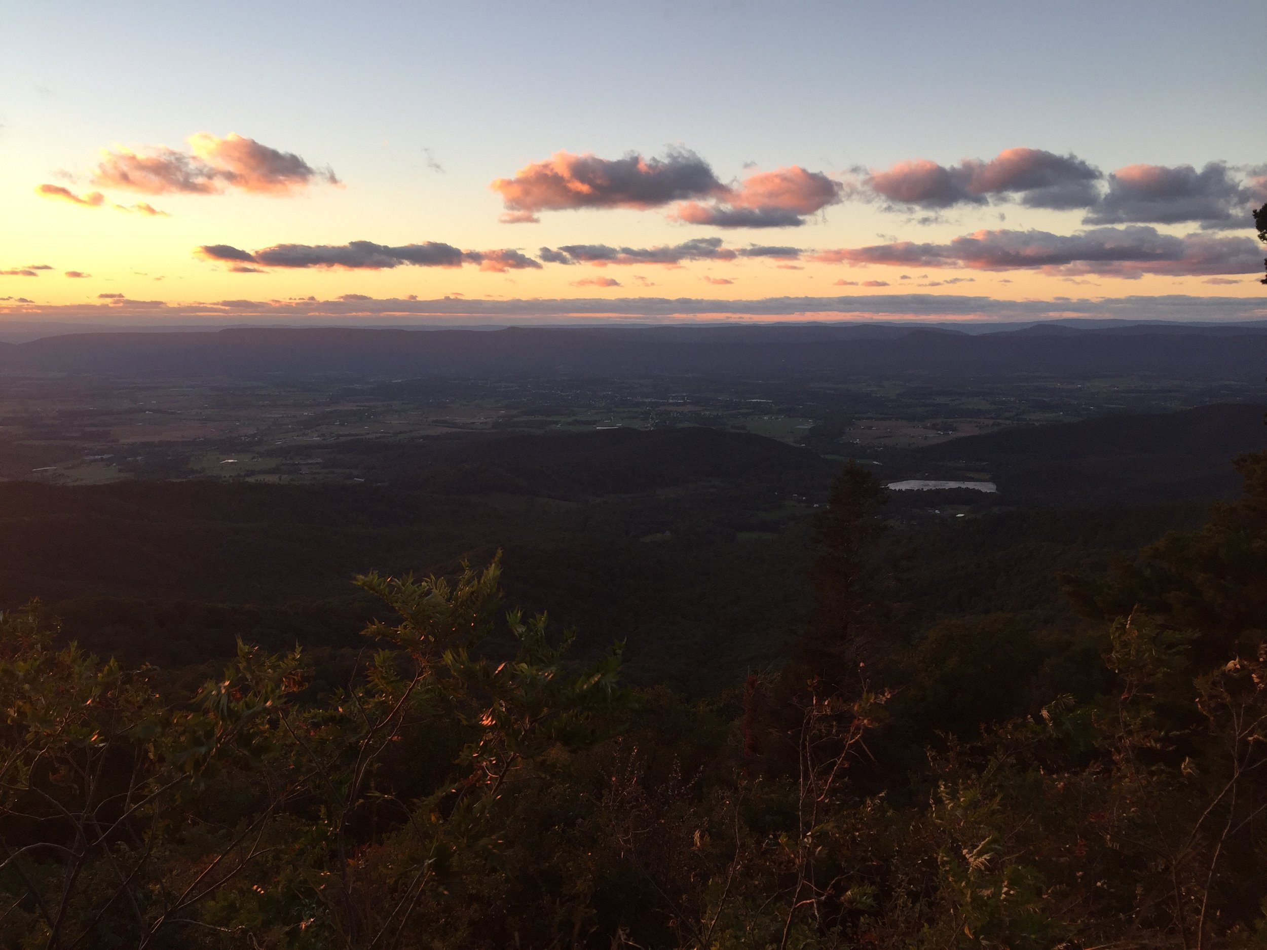
One vantage from the Stony Man summit.
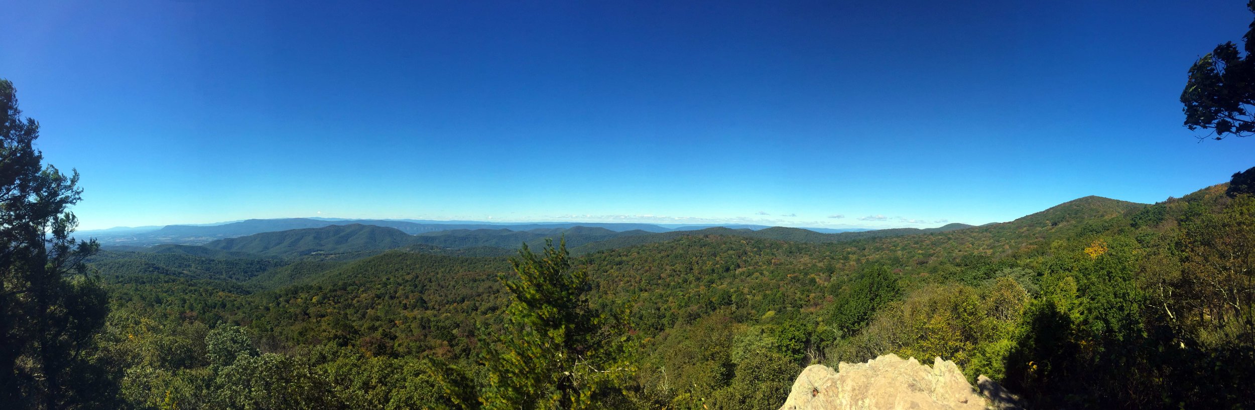
Between mileposts 66 and 29 are two hospitable and scenic waysides, Big Meadows (milepost 51.2), a stroke of prairie between the mountains that is lovely for picnicking and walking, and Skyland (between mileposts 41 and 42), with a full dining and tap room, a café counter, and sweeping views of the valley from glass windows and an outdoor patio. At milepost 53 we hiked the Bearfence Mountain Trail, which has two options, one with a rock scramble and the other a gradual uphill grade; there is one point in the scramble where the passage is narrow and the drop-off steep, but if you continue on you will be rewarded with 360-degree views of the valley from the top of the rock formation. The gradual climb also yields very rewarding views, with smaller rock outcroppings accessible from the trail. The Limberlost Trail, accessible from milepost 43, is a popular trail and a good place to catch your breath; it is a level, meandering walk, with great wheelchair accessibility. In autumn, it is a golden road, and to keep level with the trees is to appreciate their enormity. We consider the Stony Man summit just south of milepost 40 “not to be missed” – it is the second highest point in the park at 4,011 feet, after the nearby Hawksbill summit, the highest at 4,051 feet. The near and far textures of the trees and mountains had us solemn and watchful for several minutes. Across the drive from Stony Man, Thorofare Mountain and Hemlock Springs overlooks are striking. We watched the sunset at the Stony Man overlook, at milepost 38, before continuing to Luray.
Other overlooks we can recommend firsthand for their dramatic peaks and unexpected topographic shifts include Spitler Knoll at milepost 48, Hogback at milepost 20 and Range View at milepost 17, where we ate lunch on our last day. Other recommended day hikes (and we would love your recs as well) include the Little Devil Stairs overlook (milepost 20), Big Devil Stairs (pickup just north of milepost 17 at Gravel Springs Gap), and Old Rag Mountain, which is considered the most popular and also most dangerous and crowded by the NPS; read more here.
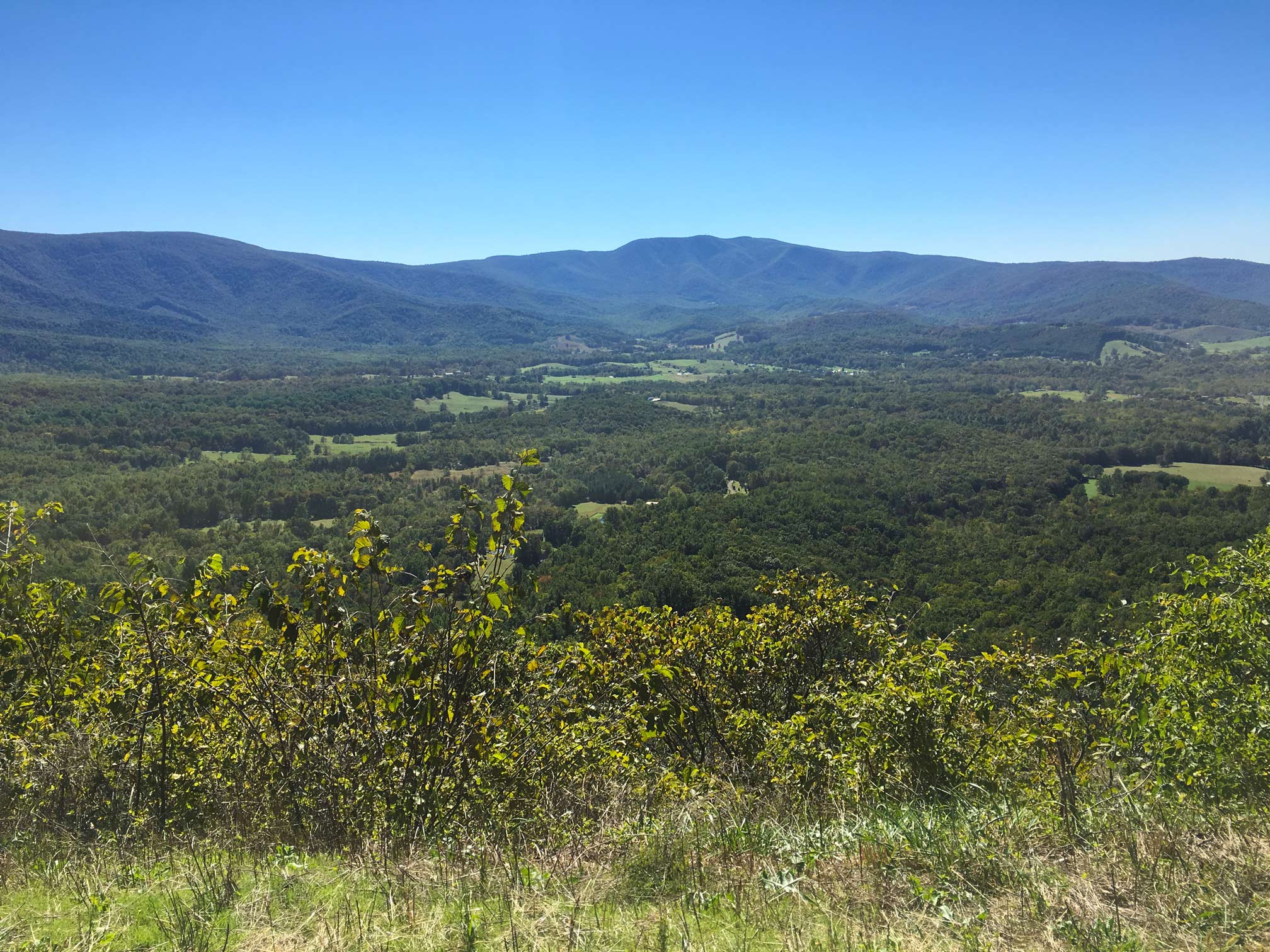
Valley views from lower elevation at Dickey Ridge.
The overlooks at the north end are at less elevation, and offer a fantastic lowlands quality; there is a vast overlook of the valley from the Dickey Ridge Visitors Center at milepost 5. The Luray Caverns (in Luray) and, the Skyline Caverns (in Front Royal) are tourist attractions to visit if you want to get into the mountains.
Further north, we also stopped at the Fort Windham Rocks via Compton Gap at milepost 10, remnants of a series of lava flows millennia ago. Via the Dickey Ridge Visitors Center, we hiked the Fox Hollow trail, which begins across the road from the visitors center and loops downhill and then up again, through forest that was once the Fox family settlement, dating back to the Civil War. Here you can also take the Dickey Ridge trail, which will lead you on a loop to the Sneed Barn, the only barn left in the park, and a glimpse of what life was like for those living here in the 20th century.
Our journey continued northward, to the Cedar Creek and Belle Grove Historical Park, a relatively new NPS site. The visitors’ center is an office in a small strip mall in Middletown, VA with an electronic map detailing the truly dramatic Battle of Cedar Creek, a turning point at the end of the Civil War; there is also a nicely organized museum and thoughtfully curated bookstore. The only way to experience the park is via a driving tour, and you can download a podcast that describes the stops or borrow a CD from the visitor center. An app (download here) has additional info to guide you, though note it is not produced by the NPS; the park also gives a thorough companion booklet with a lot of historical detail. It is tricky, as there are almost no markings on the ten-stop tour through farmland and country roads, though the podcast did offer relevant landmarks for the listener to be sure she or he is at the proper stop. The tour does give you the scale of the battle and traces the steps from the pre-dawn surprise assault by Confederate troops to the late afternoon Hollywood-style reversal of fortune leading to a Union victory. Each stop makes you understand the sacrifice on both sides and the true human cost of this war. We continued north to a Holiday Inn in Manassas, five minutes from the last NPS site on our tour.
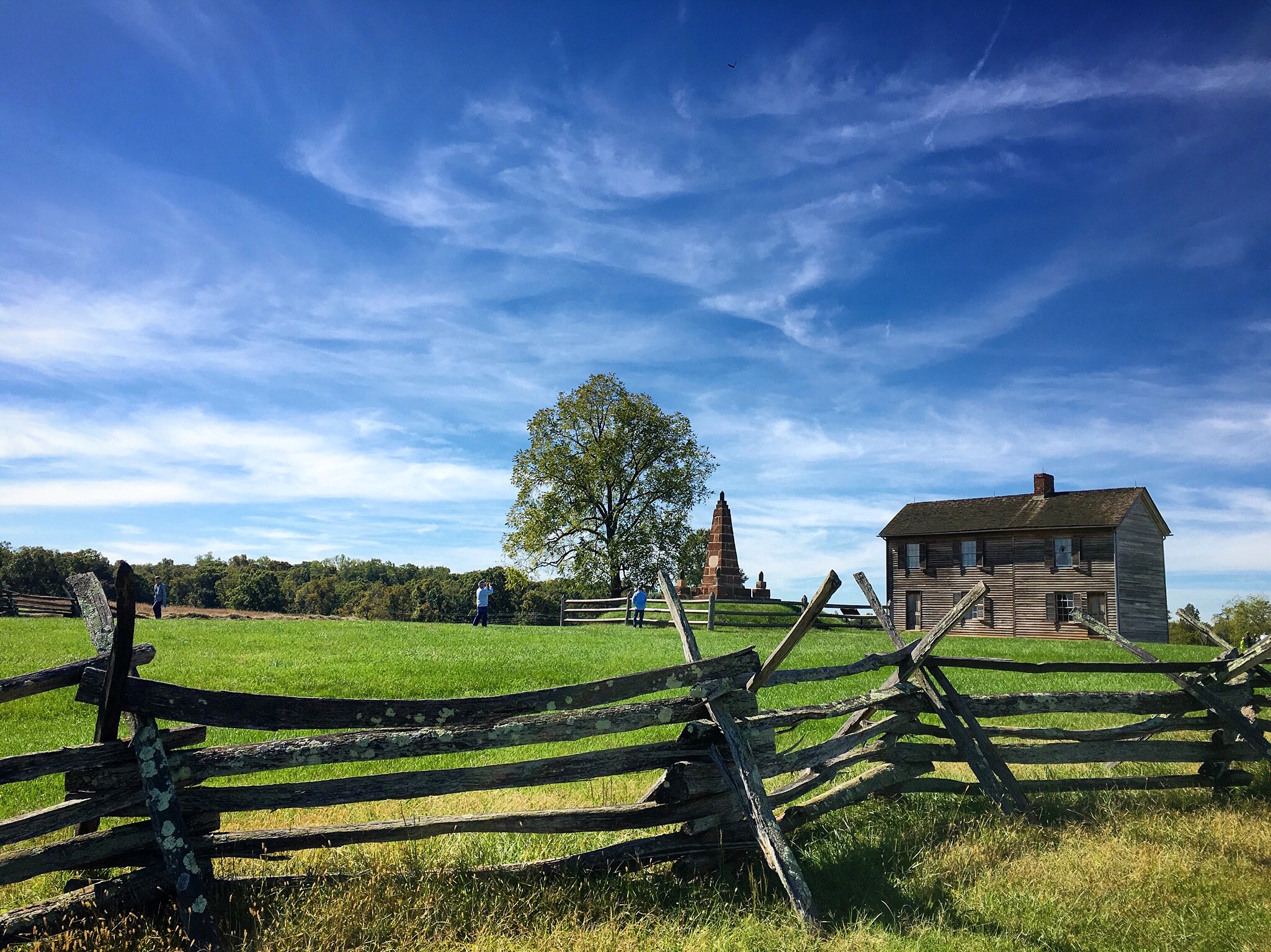
Hill house, Manassas Battlefield.
Manassas National Battlefield Park was created in 1940, and interprets the two Civil War battles that took place on these grounds. Two professional volunteers welcomed us, and we were in time for a ranger talk, just outside of the visitors center on Henry Hill, about the first battle in 1861. This park is pastoral, yet the history is sobering; both battles at Manassas, or Bull Run as known in the North, ultimately exacted a casualty toll that was unimaginable at their outsets. There is a one-mile walking tour from the visitors center that covers the first battle and the key sites. This battle was the first major encounter of the Civil War, and Washingtonians and locals watched, dressed in their Sunday finery. They, and Union generals, anticipated a swift defeat of Confederate forces — yet all were caught off guard by both the ingenuity and might of the Confederate army. As a stark reminder of how the scale of the war progressed from the first battle, the walking tour of the second battle, which occurred in 1862, is six miles long, with twelve stops on the driving tour. Note that a few of the turnoffs are a bit tricky, the drives narrow and not amply marked with signs. Parking can also be at a premium, but is manageable. The walking tour will take more time, though moves through a largely level and scenic rural landscape.
We flew home through Charlottesville, closing out the loop, and look forward to your observations and recommendations for Shenandoah.
The Point Overlook, milepost 55.5.