Enigmatic Fraser Island
Guide by Cristian Silver
OVERVIEW
Islands are not unique in the scheme of things, but Fraser Island – a short ferry ride from Queensland’s Sunshine Coast – is the beautiful accident of sand and wind. No bedrock, no volcanic uprising or tectonic history. Formed over millennia by prevailing winds shifting sand north-easterly from the coast, its mass was eventually exposed over the post ice-age ocean. Valleys and hollows filled by reliable subtropical rain formed pristine lakes, and seeds followed in the wind, settling in the thin, mineral-rich soils to rise as now-isolated species. Migrant birds and fish found refuge, and mankind followed; the Butchulla aboriginal people named it K’Gari – paradise.
Fraser’s Great Sandy National Park is managed by Queensland’s Department of National Parks, Recreation and Sports (formerly Queensland Parks and Wildlife Service), and protected as a World Heritage site — yet increasing tourism tests the limits of best practice and responsible operation. As the ferry pushes gently over the open water we have time to contemplate these things, but my old road trip pal tells me I worry too much; this is a holiday, we’ll be hiking, swimming, looking for dingos – have a coffee, man. The ferry mascot, a solid ginger tomcat, peers intently through pairs of legs as the Island looms grey-green under an overcast September sky – he knows something.
It’s not difficult to hike Fraser – time is all that’s needed – but it is easy to become lost in the more wooded parts of the national park. Detailed information boards and maps from NPRS provide guidance enough to stop city-dwellers from straying. Self-touring is also a well-catered for option. Sure, you can walk it, but access to the popular trails is mostly along the middle half of Seventy-five Mile beach – about thirty-two and a half miles. Little track entrances invite the walker at various points, looped to reach popular locations with camping facilities, easily reached and explored in a day.

Hoop palms, Wanggoollba Creek Track, photo by Harry Meeking.
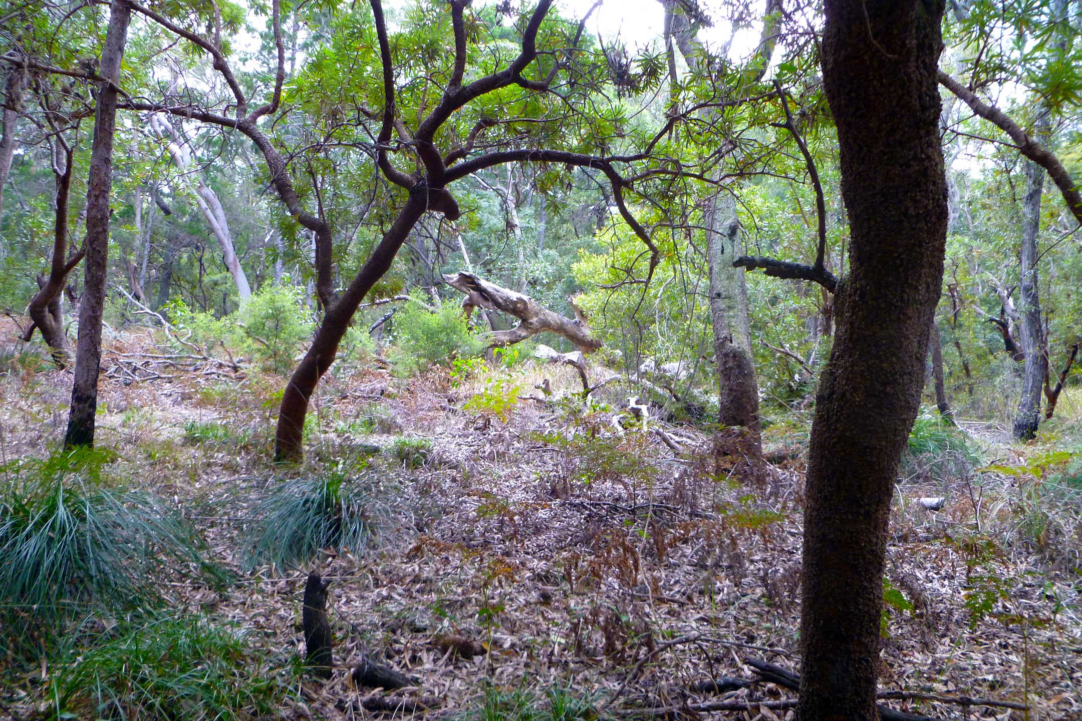
City-dwellers spooked by tour guides’ dingo, snake, and spider spiels approach the first ‘track’ like dingos skirting National Highway 1. At Wanggoolba Creek – a name suitable for scripting as much as eco-touring – we’re quickly immersed in dense, pre-ice age forest, much of which has long vanished from mainland Australia. Along the gentle stream, history speaks; an ancient satiny ‘scar-tree’ bears the mark of a Butchulla man – seven or eight feet of bark peeled vertically from the shady-side – who used it form a canoe, centuries ago. Opposite is the rain-smoothed stump of another, felled much later by the saw of a mainland stranger. The old-time loggers, conservative in their technique, rotated cutting to allow regeneration, but depleted much of the prized old-growth kauri and white beech ferried mainland and beyond. Prehistory is preserved here, in isolation. So too are many content snakes, spiders and killer mosquitos. Bring your insect repellent and your lace-up boots.
The need to preserve Fraser is immediately felt, as is the realization that it could have been another story, had conservationists not won Fraser’s case for World Heritage Recognition. During the Pacific Campaign of World War II, Fraser’s unpopulated beaches, dunes and peculiarly juxtaposed variety of vegetation served well for Commando training and heavy artillery practice. Soon after, attractive profits were realized in sand mining; Fraser’s pure sand contains useful minerals and was ferried onshore until a government-imposed ban was enacted in 1977. Commercial logging finally ended in 1992. Like many government-owned lands, preservation came from recognition of its abuse, and mainly by heeding the protests of conservationists. It’s amazing what a small group of well-informed and inspired people can do.
And yet, tourism thrives. Four-wheel-drive wagons and buses roam Eastern Beach like giant Tonka Trucks in a sand-pit. Tents and fishing rods propped in the shoreline mark camp territory. Parents and children float along Eli Creek towards dry towels and sand-blown picnic lunches. Can it really be this busy? Visitation is capped, we’re told by a uniformed park ranger, at one thousand per day. Isn’t that nine-hundred too many? Relax, my friend tells me, they have it all under control – have a banana.
Wozza has many years of sand-miles written into his cheerful face, and the unique skill of commentary while four-wheel-drive-bussing. He holds the beast steady, slightly tail-out along the shoreline. Dolphins follow us doing a steady 35. Eastern Beach is a gazetted national highway and the posted speed limit of 80 KPH is easily achieved on the flat shoreline. Recent legislation requires a mandatory four-wheel-drive safety course, following frequent ‘roll-overs’ by careless backpackers and beach-hooligans – take care as a driver and as a pedestrian.

The Maheno, photo by Harry Meeking.
The rusting frame of The Maheno, a retired passenger liner that ran aground during a cyclone in 1935, invites experiments in photography. The collapsing frame compliments its resting place, though it divides opinion – we overhear a visitor remark that she doesn’t want to look at a bloody rusty old ship, while an earnest urban sailor explains the fallen beauty’s various structures to a patient friend. Through a porthole, the timeless South Pacific rolls on.
Compressed sediment lining a sand-hollow and fed by reliable rain makes postcard-perfect Lake Mackenzie a natural swimming pool and a good choice for the turnaround point of a day-hike from Eurong. With new eco-accredited facilities, visitor numbers are also capped daily to help preserve the lake’s unique alkalinity. Nature walkers find the reeded fringe of the lake a haven for native glider possums, ducks, alkaline-sensitive frogs, geckos and non-poisonous carpet-pythons.
The track to Lake Wabby, photo by Harry Meeking.
Driving north still, the track from the beach to spooky Lake Wabby is only a mile or so, but fifty miles of possible photos follow; coastal heath becomes subtropical forest, then diverse dry woodland, then opens onto waves of dunes falling steeply to the deep, murky lake. Parts of the track are eerily quiet, confusing, and indeterminate forms disappear as you look back at what you thought you saw. People have gone missing for days, looking for island secrets. So just swim, hike up the dunes and listen to the echoes of your name called from below.
The coast gently curves from the rising sand-blows that form Fraser’s ranges, and at the north end of Eastern Beach the sandstone outcrop of Indian Head rewards with a panorama of contrasts – a dozen photos here could be of as many different places. Below, sharks circle a giant tortoise then give way as a whale emerges, in slow motion. West is the varied terrain, the lay of earth over sand arranged by wind and time, east is the endless South Pacific and the wind at your ear, slowly just shifting Fraser’s dramatic contrasts and improbable landscapes.
And dingos? These are the purest of the species, an Asian wolf likely bought to shore by aboriginal visitors – no one is really native, if you count back far enough. There’s no guarantee you’ll see one, though, but comments of tourists today are hopeful. ‘Dog-gates’ prevent encounters within resorts; though attacks are rare, visitors are warned not to interfere.

View from Indian Head, photo by Harry Meeking.
You can camp, go five-star or enjoy the structure of a tour. Eurong Village has everything need and the original 1960's resort caters nicely to all budgets; subsequent development elsewhere – like swishy Kingfisher Bay Resort – is ‘minimal-impact’ and sensible. As I search the pool and lounge for people in leisure suits, a queue forms at a pay-phone – cell phone service is sketchy. The food in the cavernous dining hall is okay. My friend asks me how many islands have we been to lately, relax – have some more pudding. Distracted by an off-duty server, I excuse myself, but before pudding numbs my senses, I close the gate behind me and walk down to the beach for no particular reason. My dingo is there. We watch each other, pale in the twilight, unafraid.
GETTING THERE
A hire-car or Greyhound Australia’s daily services ex Brisbane (3 ½ - 4 hrs) is practical, to popular Hervey Bay (gas US $4.00 per gallon / AUD $1.25 per litre at Jan. ’17) or Rainbow Beach, nearer the island’s southern tip. Avoid driving dusk-dawn on the Pacific Highway (National Route 1), which remains undivided and heavily-repaired in sections. Major rental agencies, chain and resort accommodation for all tastes, is in Hervey Bay. Passenger vehicle barge services run daily from River Heads near Hervey Bay (bookings only), and Inskip Point at Rainbow Beach. Tour companies provide passengers with pick-up from & return to popular accommodations in Hervey Bay. QANTAS domestic, provide several flights weekly to Hervey Bay ex Brisbane and Sydney.
WEATHER
Fraser Island is situated in a sub-tropical coastal zone subject to varied and erratic weather. Cyclones, heavy rain and wildfires are possible year-round, especially November thru March. Daytime temperature range varies between 65 & 90 degrees (F) most months, with medium-high humidity – April thru September is best. Most useful is a current Fraser Island Conditions Report, regularly updated, available in PDF from Queensland Government’s Department of National Parks, Recreation and Sports, or print at various departure points.

The "Pinnacles" photo by Harry Meeking.
SAFETY AND PLANNING
Some walking tracks within the park may be closed (check Conditions Report!) so a ‘Plan B’ is handy. Self-driving (four-wheel-drive only) and ‘tag-along’ tours are suitable for extended visits; a safety briefing is mandatory, sand-driving experience useful. Camping and vehicle permits must be paid and booked in advance through NPRS. Note that island-bought fuel and supplies are island-priced. Follow NPSR guides regarding dingos, seasonal (summer) stinging marine jelly-fish, sharks (year-round) and whale-watching (Sept-Oct.).
Avoid swimming in the ocean and yield to vehicular traffic on Eastern Beach. Carry water for at least eight hours on a day-hike, as tap water is limited to main campsites and localities. Depending on your route chosen, you may walk four hours between locations, so plan for your return. Public restrooms are available at most campsites. Payphones available at major camp-sites. The comprehensive Fraser Island Visitor Guide from NPRS is available from their website: www.nprs.qld.gov.au
TOURS
Tours are economical and an ideal way to see the ‘best’ of this large island, especially on a tight schedule; author and photographer travelled with Fraser Explorer Tours, a three-day expedition from Hervey Bay. The value is food, and the trip varied, with long stops, an informative and friendly driver/tour guide, with comfortable accommodation and meals included.
PACK
We each packed one change of clothes, lace-up shoes or boots, a sunhat, light raincoat, pullover, sunscreen, insect-repellent, loose change for the pay phone, and a spare towel. No vaccinations or special fitness levels are required, but note emergency services are limited on the island. Prescription drugs may not be available, and must be cleared by customs on arrival in Australia – pack your insurance, too!

Cristian Silver is a writer, extra, film stand-in and tour guide from Melbourne, Australia. His work has found him engaged in various U.S film productions based in Melbourne, many tours to Victoria’s Great Ocean Road with international visitors pursuing postcard vistas and marsupials, and driving express bus coaches along the white line between Melbourne and Sydney. Apart from a Diploma in Writing and Editing, his qualifications are strictly travel and tourism. He’s chasing a life-long, one-way affair with California and is planning further travel to the U.S and Canada. He’s currently finishing a feature-length screenplay, soon to be sent to the overflowing files of the Writer’s Guild.